


|
7/12/2026
10:54:34 AM |
||||||||||||||||||||||||||||||||||

|
||||||||||||||||||||||||||||||||||
| Mostly cloudy | ||||||||||||||||||||||||||||||||||
| 89.4°F | ||||||||||||||||||||||||||||||||||
| Warm | ||||||||||||||||||||||||||||||||||
| Feels like: 90.5°F | ||||||||||||||||||||||||||||||||||
|
||||||||||||||||||||||||||||||||||
|
||||||||||||||||||||||||||||||||||


Area Forecast Discussion
National Weather Service - San Joaquin Valley / Hanford, CA
Issued: Saturday, July 11 2026 - 11:11 PM PDT
KEY MESSAGES... 1. Slow but steady warmup this week, with widespread Moderate Heat Risk by Tuesday with isolated areas of Major Heat Risk.
2. Increased chance for Sierra Nevada thunderstorms late this weekend into next week with monsoonal moisture pushing into our region.
3. Practice safety around lakes, rivers, and streams, as water is still running cold.
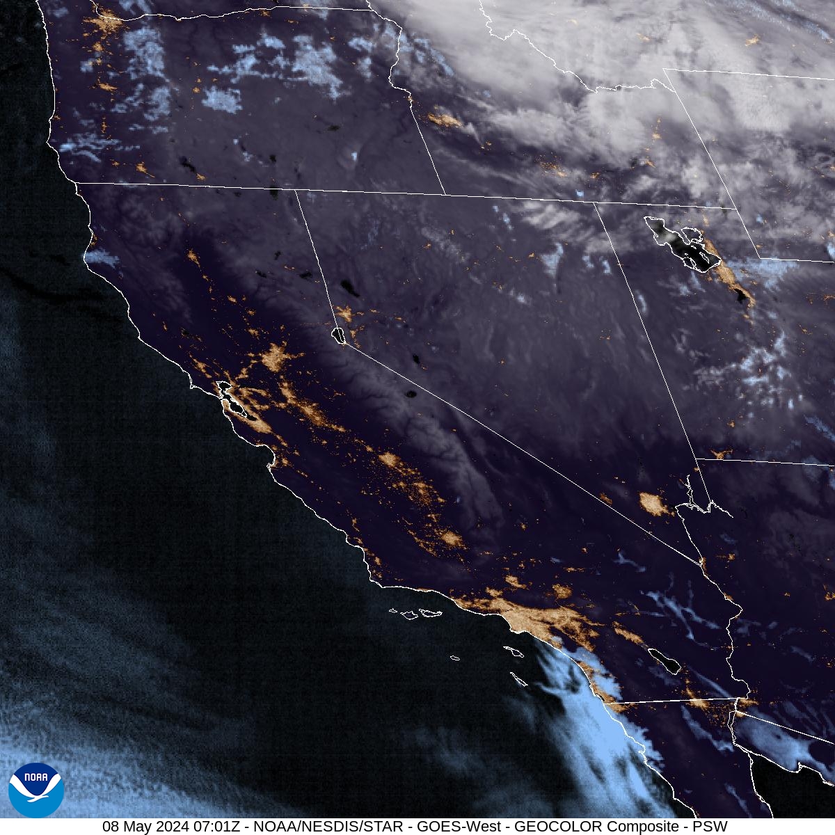
DISCUSSION... Current satellite imagery shows a layer of high cirrus clouds spread over much of Central California and into Northern California, indicating that moisture is advecting at the high levels of the atmosphere right now while the surface relative humidities remain fairly dry. This is expected to change as more moisture is pulled up from the south through the next few days. Sunday will see a slight chance (5-10%) for thunderstorms over the Sierra Nevada crest, and mainly at the highest elevations. These chances then jump up to 15-30% by Monday as the amount of moisture increases throughout the region. Similar chances are seen on Tuesday before they move slightly east and decrease into the 10-20% range on Wednesday. Then each afternoon will see that range of chances on the Sierra Nevada through the rest of the week into next weekend.
As a result of all this additional moisture and cloud cover, low temperatures at night are expected to rise from the low to mid 60's into the low 70's in the rural areas and the mid 70's in the urban areas, such as Fresno and Bakersfield. This along with the highs in the mid 100's will lead to Moderate Heat Risk throughout the Valley and the Mojave Desert, as well as pockets of Major Heat Risk that are mainly in the southeastern Valley and the southern Tehachapi Range in Kern County. The hottest days are expected to be from Tuesday through Thursday as the Heat Risk has the highest chance of being Major, at 40-60% in those regions mentioned above. This level of Heat Risk affects most of the population, especially if there is no access to adequate cooling at night.
Looking to the long term forecast, the Climate Prediction Center has much of California in the leaning above (40-50% chance) normal category for temperatures in both the 6 to 10 and 8 to 14 day outlooks, as well as a slight risk for hazardous temps from the 19th through the 25th of July, which are both indications of the continuation of these above normal temperatures that have been seen throughout this month.
AVIATION... VFR conditions expected across the area for the next 24 hours.
AIR QUALITY ISSUES... None.
CERTAINTY...
The level of certainty for days 1 and 2 is high. The level of certainty for days 3 through 7 is medium.
Certainty levels include low...medium...and high. Please visit www.weather.gov/hnx/certainty.html for additional information and/or to provide feedback.
HNX WATCHES/WARNINGS/ADVISORIES... None.
